Useful Maps of Cornwall
Find you way around with a useful guide
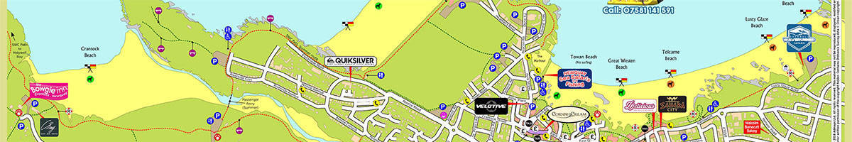
Free Maps of Cornwall produce useful downloadable maps of the local area.
The handy guides highlight all the essentials such as footpaths, picnic areas, car parks, toilets and the location of ATM machines.
Further important information on beaches such as lifeguard cover, flag safety and dog friendly beaches are listed as well as the location of local visitor attractions.
Maps are split into smaller area guides with titles such as ‘Newquay, Fistral and Crantock’ or ‘The Seven Bays and Padstow to Mawgan Porth’. Most recently, a handy guide to Poldark locations has been produced!
Titles include:
- Newquay, Fistral and Crantock
- The Seven Bays and Padstow to Mawgan Porth
- The Camel Trail, Padstow and Wadebridge
- Port Isaac, Polzeath and Rock
- St Austell Bay, Mevagissy to Fowey
- St Ives, Carbis Bay and Hayle
- West Cornwall’s Penwith Peninsula
- Looe Bay, Polperro, Looe and Seaton
- Poldark Guide
Download or take away
PDF copies of the maps can be downloaded or requested and delivered via post. Alternatively, pick one up from the hotel lobby during your stay.